Sunday, June 27, 2010

The kind of initiative that a place like Stoney Creek should consider

It's called 'Transition Network'. Take a look at what they're all about.

After all, to paraphrase the British supermarket Tesco, 'Every little bit helps.'

(Speaking of, I'm compelled to feature this spoof ad...which is apropos of what the linked initiative is all about.)

Monday, June 21, 2010

Exploring Battlefield Park...a new way.

Battlefield Park, From Battlefield Drive

Out and about.

Henry and Beatrice Warden Park

In neighbouring news...

Cal DiFalco has a blog, The Hamiltonian. It's a wonderful source of information, of discussion, of exchanges of ideas pertinent to Life in Hamilton.

Cal was kind enough to send me out this press release regarding an issue fundamental to a primary focus in his own life, the Fruitland-Winona Community Advisory Committee. Please take a look.

Sunday, June 20, 2010

Summer following spring.

From the final spring evening...

...to the first summer morning.

Saturday, June 19, 2010

Out and about.

Area Trek, v7.0

The Battlefield Park Master Plan, Part Three: Arcana

1) From the 'Battlefield Park National Historic Site Master Plan':

"There are three access points from the park to the adjacent subdivision street. One of them is at the ravine at the north end. The second one is a third of the way along at Robb Street and then a final access point at the very southeast corner of the park.

Even though there is public land that reaches out to the subdivision, the woods and the topography of the park site restrict the feasibility to develop formal walkway entrances into the site.

Creating new entrances at these locations would require significant grading to make the access points barrier free. It would also involve a great amount of impact on the forest collection as well as requiring new bridges to cross over Battlefield Creek.

OK, I'll bite: Why would anyone want to add any access points onto a residential street?

I can't fathom why this was ever brought up, all things considered. (Never mind the fact that Robb Avenue is more than halfway along, and I can't for the life of me identify the north access point.)

2) The proposed 'gateway' entrance at the north-west corner seems to me, according to the Plan, to be designated as the primary pedestrian entrance.

Um...who walks to Battlefield Park from that direction?

Seriously.

Has anyone ever done a study as to how foot traffic approaches Battlefield Park? (Never mind the fact that I'm guessing that the ratio of local foot-traffic to car arrivals -here I'm including the shuttle service during the reenactment- must be almost infinitesimal.)

And the foot-traffic that does arrive? I bet you a kajillion dollars that it doesn't come from the west. Maybe up Centennial. Some. But from King Street East (in Hamilton)? What, people walking from Greenhill? Doubt it. They're going to drive.

So what we get -from my jaundiced point-of-view- is a 'gateway' from Hamilton.

Effectively prioritizing...Hamilton.

Right. Qu'elle surprise.

I'm not taking issue with the notion of a Park 'welcome' being at the at corner. I just find the notion that such a priority is being put on this entrance...to the extent that trees are recommended cut down in order to improve 'the view'.

Of...?

Of Grandview.

Huh?

A feature that's not actually endemic to Battlefield Park is so important that it's effectively mandating how this 'gateway' is going to end up being constructed, sightlines-wise.

I was just there this evening, on my daily trek, and I was trying to figure out the basic precepts of visibility and awareness, etc.

And I have to say that the idea that you have to shine a light, have a stationary 'show' in place for a National Historic Site seems to be a case of placing the emphasis where it need not be put. Um...overkill, anyone?

Locals know where it is, what it is.

People making a special trip, a 'day out', they know where it is.

So there's going to be this wonderful gateway, this open vista to 'Grandview'...and a pedestrian pathway that the majority of foot-traffic won't actually be using.

Okaaaaaay...

3) I am curious as to how the Stoney Creek Cemetery is going to be incorporated into the overall picture, seeing as it's considered as being as important an element of the area as the Park itself and Smith's Knoll. (It was where the initial engagement took place.) Right now, it's got a decidedly nondescript profile, very much a forgotten entity. (There's a photo album here for your viewing pleasure.) Considering there's a wealth of subdivision development in the offing to the south of the Cemetery, and that vacant lot next to it on the south-west corner of Centennial and King, I suppose just about anything might possibly unfold.

4) I did have a good laugh when the Plan referred to the Devil's Punch Bowl as the 'Devil's Pulpit'. I felt I was in Montana or thereabouts.

The Battlefield Park Master Plan, Part Two: Trail Use

I feel no hesitancy in stating that for me, the most important element of 'the west side' of Battlefield Park is Nature. Going through the Park, going through its natural beauty is part of my daily routine, it's an integral part of my life. I don't expect anyone else to place the same importance on it that I do, but at the same time, I don't expect anyone to try to get me to see things differently, to somehow change my perspective; lovers of local history have their treasures to embrace, I have mine. (Remember, this blog exists primarily because of my connection to Battlefield Park- Well, more accurately, how a perceived part Battlefield Park being clear-cut elicited a visceral reaction in me, prompted me to get on my blog-based bully pulpit and begin declaiming against certain local asshats...and their decidedly asshattish behaviour.)

One of the 'observations' made by the 'Battlefield Park National Historic Site Master Plan' was that the Bruce Trail 'connecting path' (my reference) was problematic. For several reasons.

The first had to do with how the Battlefield Creek ravine is in need of better maintenance than it's gotten. There are flora and fauna concerns that the Plan covers in detail, so I won't go into them here, but at the very least, things need to be protected, if not made better. I can't see that being against proper and engaging stewardship of these resources is a cogent mindset. (Though there may well be cogent arguments against some of the suggested policies. But I'll reserve judgement on that topic, thankyouverymuch.)

But I suppose there were enough comments made in the Plan to have the cynic in me rise up, to bring to mind the possibility that the entirety of 'the west side' of this 'National Historic Site' will be bureaucratically 'managed' to a suspect level.

This has nothing to do with me wanting to 'keep things as they are', especially if we're talking about genuine concerns about what grows and crawls and flies in and around this admittedly sensitive area. It has more to do with the notion of taking the use of a piece of Nature and figuratively putting it under glass.


"The issue of access across park land to the Bruce Trail is something that is to be further investigated since the informaltrail leads to private property and an unprotected rail crossing. Directing visitors down a path and into this situation may not be advisable from the City’s point of view unless the Bruce Trail Association has agreements with the adjacent landowners."


This section addresses what I interpret to be concerns about litigation resulting from someone heading from the proposed interpretive building, onto the Bruce Trail connecting path, who then has a 'mishap' at the TH&B tracks, even before they've arrived at the Bruce Trail-proper. Clearly this is risk-management at play.

And the solution? Remove the Bruce Trail designation? Possibly.

The fact is that there are human-constructed steps at the embankment of the railway tracks. On either side. No matter that both chunks of property are 'private', people head from Battlefield property up these steps, across the tracks towards the Bruce Trail. People also head across the tracks at the Centennial Parkway overpass. There is no 'pedestrian crossing' and frankly, there never will be.

So short of a) closing off the ravine trail, and b) fencing off the actual Battlefield Park property, I can't see that this is a controllable situation from Battlefield's point-of-view, no matter how much discomfort this trail-use-and-potential-litigious-disaster scenario brought the composers of the Plan.

Moreover, I would mourn a surfeit of 'control' being exerted over an area that has been allowed to retain whatever 'naturalness' it possesses. (Yes, I'm well aware that all of these lands have been impacted by human presence, that even the selection of tress is not 'natural', so in fact, my attachment is compromised at best, romantically-flawed at worst.) The main pretty much from King Street to the southern verge of Battlefield Park property has changed so much over the years, and almost all of it at our hands. Take a look at this aerial photograph from 1954, courtesy of the Plan (and the City of Hamilton Special Collections):

To the west of 'the east side', Gage House and The Monument, it's almost entirely orchard. (Three bits of this photograph that really piqued my interest: a) the fact that Webster Road 'off-ramped' from Hwy #20, rather than how it is today, a turnoff with a gentle curve leading to the straight-run of the road itself, all the way to the railway tracks, b) all those houses along the Battlefield side of King Street West, east of #20, and finally c) that mysterious conglomeration of...of 'buildings' on line with The Monument, snuggled right next to #20.) So at least at the forty-year mark of The Monument, we can see a major change from today...and all of it 'Man-made'.

I believe that the ravine area surely can be seen as the most 'unaffected' of any of the land of what now comprises 'Battlefield Park'. I'm all for its good and proper maintenance, but would hate to see it lose something in the process...sort of like 'The road to Hell is paved with good intentions', and all that.

Ditto our access to these less 'developed' parts of Battlefield Park.

N.B. For the record, I don't have a problem with the proposed footbridge across Battlefield Creek from the interpretive building to 'the east side' of the property. It makes perfect sense to link The Monument/Gage House portion with this new hub of appreciation of the historical elements of Battlefield Park. And I say this despite acknowledging the requirements involved to make something like this work in such a sensitive environment, as well as my foundational belief that the goal should never be to make everything available to everyone, especially where Nature is concerned. This may be viewed as something particularly 'snobbish', but for instance, I'd never want to see the Bruce Trail paved to make it 'easier' for people to negotiate. An overstatement, perhaps. But I believe in this materialistic, acquisitional world of ours, it's vital that we have an appreciation for what's important, and this appreciation should often come with the price of simple and honest physical effort.

The Battlefield Park Master Plan, Part One: Changes


I've read it through several times now. (And yes, I've learned a lot.) And somewhere in there I went into the Stoney Creek News website and did some searching for published content. I didn't come up with much, just this article and this Letter to the Editor.

Once you take away the elements to the Monument side, and the King Street frontage plans, what you're left with are some relocations of structures (such as the barn) and...

...the construction of a 20,000 sq/ft interpretive center and a footbridge across Battlefield Creek.

I'll admit that when I first heard about the plans, especially about the interpretive centre portion, I was wondering whether Those Who Were Considering All This might be reaching a bit. That maybe their sights were a little too high. You know, as in not so much trying to make a silk purse out of a sow's ear, but in being maybe a tad pretentious. Besides; why would you want to inflict nasty development on land that had served so simple a purpose for so very long?

Having read the Plan, I think I can see better not only what they want to do, but moreover, why I flinched at the notion of such a drastic makeover.


Please bear with me as I attempt to apply some context to Battlefield Park from a personal perspective, and forgive me if I'm unable to entirely nail down facts.

My relationship with Battlefield Park has almost entirely been with what they refer to in the Plan as 'the west side'. That's not to say 'the east side' had no meaning. I remember playing football on the grass in front of Gage House, and tobogganing there, too. And the steps of the Monument will always hold special meaning to me, due to a personal interlude back when I was a late teen. And of course, the tower itself is foundational, as much as the cross at the Devil's Punch Bowl is; they're both physical reminders of Stoney Creek, proud mnemonics, if you will.

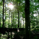
To me 'the west side' has always meant 'nature'. I'm sure my family picnicked there when I was a kid. I know I was there as a teenager with friends; there's a photo out there somewhere of me playing guitar at one of these get-togethers. And certainly since I've been back in Stoney Creek, since 2005 or so, what I've connected with are the open spaces, the creekside trail, the wonderful Nature-ness of the ravine.

So for me, the 'park' aspect of Battlefield Park has always meant the most. That's my bias. It should be no surprise then, that my gut reaction to taking away some of the west side's lawn to create an interpretive centre (and accompanying parking lot) wasn't a good one. But then I read the Plan, learned some things, and found myself coming around.

From what I can tell (and again, apologies for either being dense or not having done the required research), the Women's Wentworth Historical Society's original effort was Gage House, the Monument, the front lawn...and presumably the land behind it to the south, east of Battlefield Creek, west of Battlefield Drive. That's it. Back in the early 60s...1963?...the Niagara Parks Commission took over and (again, presumably) combined 'the west side' with what the Women's Wentworth Historical Society had created, so the area stretched from King almost to the TH&B railway tracks, Centennial to Battlefield Drive. And for most people old enough to 'remember', this 'latter part of the 20th century' development is what they base their references on. The reenactment has been presented for less than three decades, so this reference is even more recent.

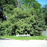
So what we had by the mid-sixties forward, was a national historic site...combined with parkland. Parkland that was used for picnics, and because it had a bandstand, concerts.


Take a look at the above map. It's from the August 2002 Parks Canada Commemorative Integrity Statement for The Battle of Stoney Creek National Historic Site of Canada. For me, two things of interest pop out. The first is the 'Designated Place' bit; it stretches all the way down through Merlo's Clear-cut to the TH&B railway tracks. But the more telling bit is the 'Approximate location of the Battle'. Which as far as 'the west side' goes, seems somewhere in the vicinity of the washroom/concession/picnic shelter/pavillion. That's as far south as they had determined any remnants of 'battle' to be.

This means that while the entire area for a good, wide radius could reasonably be deemed to have been where some elements of engagement took place, from their perspective, everything south of the building that currently sits there...meaning, of course, where the reenactment occurs...is not in fact, 'historic ground'. Not in the same way that 'the east side', Stoney Creek Cemetery and Smith's Knoll are concerned. (And playing Devil's Advocate here, if all the green space in question -the broad strip from the parking lot all the way to the railway tracks- is as hallowed a section of ground as all of the above...why are we allowing picnics to be held? Why are dogs allowed to romp through there, why are joggers and hikers permitted to do what they do?)

At the core of the Plan seems to be this: a sincere effort to shift the Battlefield Museum and Park towards a more reverential, a more stately, a more 'serious' profile. To update things, to be sure. But more than this, to leave the former perception of 'the west side' behind.

Proof? Sure; here are some extracts from the Plan:


Proposed work on the west side of the site primarily relies on construction of the interpretative building, the relocation and restoration of the barn, the provision of a new maintenance building to accommodate park staff activities and new parking and a trail layout with a new pedestrian bridge. The above works shall be undertaken in phases as Capital Budgets allow.

Other improvements on the west side include construction of a berm along Centennial Parkway. This berm will assist in noise mitigation and when planted will provide a visual background to the historic site. As well, the berm will provide viewing opportunities for reenactment activities which will continue to be accommodated south of the proposed parking lot. A new gateway feature and public art installation are proposed for the King Street West frontage.

Further, many uses of the park are not compatible with the sites values as a National Historic Site and will be discouraged in the future. These activities include tobogganing and large group picnics. Some facilities that support these obsolete uses will be converted to support museum uses or removed.

The large site of approximately 31 acres has many layers of history and community uses. With the upcoming Bicentennial commemoration of the War of 1812 – 14, it is timely to plan how to balance these uses and values in a comprehensive plan for the future.

There are many heritage features and figures associated with the site that have the potential to broaden its appeal to new visitors by adding to its interpretation and educational value. The current strategy for a national heritage site is to aim for a MVE, “memorable visitor experience,” in addition to protecting and conserving its heritage resources.


That's it in a nutshell: to aim for a 'memorable visitor experience'. Meaning, just as concisely, that seeing 'the west side' as a gathering place for picnicking and activities of the sort, will be a thing of the past.

How do I feel about this?

Actually, I'm fine with it. After having gone through the material, I can see that there's merit in the whole 'In for a penny, in for a pound' approach. And let's face it; this isn't a 'Stoney Creek issue' anymore. It's a 'Hamilton issue', and this means that how Battlefield relates to all the other area historic sites must be taken into consideration, not the least of which are the 'Scourge' and 'Hamilton' shipwrecks. So it makes sense to take a fresh approach to 'the west side', bringing it into the 'historical acknowledgement' game in a way that's partnered more favourably with its eastern fraternal twin.

The Plan's emphasis on 'the west side' comes down to making the most of the site, of everything that the area has come to mean to Stoney Creek, the fact that it defines so much of how we see ourselves. I have no problem with development there, with an interpretive building and everything that goes along with it, even the parking, even the footbridge...even the necessary degree of loss of southern lawn. However...

However, I am not in agreement with forging ahead with such well-considered plans and not acquiring the piece of land at the southern extremity to Battlefield Park, what I have stridently (and acerbically) referred to as 'Merlo's Clear-cut'.

So to me, if we're going to do what the Plan proposes -regardless of what the interpretive building ends up looking like, its size, its location- then I believe that the 'loss' of the reenactment area should be, and must be compensated by the extension of Battlefield Park (seeing as it's noted in the Commemorative Integrity Statement as comprising the 'Designated Place') to the TH&B railway tracks.

Considering all the other earnest observations and suggestions the Plan makes, I'm still astounded that so major an element of 'integrity' was missed.

Friday, June 18, 2010

Exploring Battlefield Creek...a new way.

Battlefield Creek, From Alba and Battlefield

A little excursion from a different direction provided some unexpected delights. (The irony wasn't lost on me that I wasn't at Battlefield, but on Merlo's property.)

...and today, it's even closer.

Battlefield Park: Its Present, Its Future


Yesterday I spent some time reading the 'Battlefield Park National Historic Site Master Plan' (2009 version). It's a 130-page document outlining the proposed changes to the area. Some have already been initiated (the removal of the houses that previously sat on King Street West, blocking the view), while others, from what I've gathered, are still under consideration.

Until I'm a little more comfortable with understanding the proposal, I'm going to reserve general comment. But there were a few elements that piqued my interest.

The first had to do with access to the Park from Battlefield Drive at about Robb Avenue. Which, I'll admit, I was entirely ignorant of. You can see it in the photo at the beginning of this post; it's the 'knuckle' that sticks out two-thirds the way up on the left of the segmented outline of Battlefield Park. Here:
I've never accessed the Park from this point. Here's what it looks like from the street (Be patient; this will eventually become a Google Street View moment):


I've sent out an enquiry for clarification about this to the kind folks at Battlefield Park, but I have yet to hear back.

The second element was a passage in the Plan dealing with possible changes to access to the Bruce Trail via Battlefield Park.

"The issue of access across park land to the Bruce Trail is
something that is
to be further investigated since the informal
trail leads to private property and an unprotected rail crossing.
Directing visitors down a path and into this situation may not
be advisable from the City’s point of view unless the
Bruce Trail Association
has agreements with the adjacent
landowners."

Leaving aside the Pandora's Box of issues regarding just how much some of the fundamental features of the Park are -seemingly- going to be changing, I was scratching my head over two bits: first, the 'private property' in question, and second, how could this 'issue' be addressed.

Going back to this post's aerial map, there's only one piece of land labelled 'Private Property', it's not Mr. Al Merlo's. It's on the south side of the tracks, what I had assumed was Niagara Escarpment Commission land. Again, I've sent off an email to a member of the NEC (who is also affiliated with the Ministry of Natural Resources) whom I discussed Merlo's Clear-cut with almost a month ago, in the hopes that he can clarify.

As for 'How this potentially litigious situation could be made to go away (think of National Historic Site visitors, having paid to visit the Interpretive Centre, then wander up the connective path to the Bruce Trail, but have a 'mishap' at the railway tracks)...well, I suppose the easiest solution would be to remove the Bruce Trail designation entirely, thereby additionally any sanctioning of its safety by the governing bodies. Short of this, you'd have to entirely cordon off the extant trail...as well as find a way to prevent any passage from Battlefield Park through Merlo's Clear-cut to the TH&B tracks and the Bruce Trail beyond. Not likely, huh?

Naturally, the final element had to do with Merlo's Clear-cut.

I was a little astounded that, in light of just how much effort went into preparing this plan, in light of the gravity that infuses its various stages, the desire to preserve the historical integrity, to restore horticultural nuances, to generally raise up Battlefield Park's profile to something more stately, something more serious, something more befitting the cornerstone in Stoney Creek's heritage...

...considering the lengths that have already been visited to pretty-up the King Street presentation, the acquisition and demolition of hundreds of thousands of dollars of buildings, the wholesale re-design of the west side of the Park's features, an ambitious re-imagining that has its undeniably contentious elements (think 'those who see the re-enactment as paramount', as well as 'discouraging' the traditional picnickers)...

...it seems rather remarkable that the south section of the Park, where Merlo's Clear-cut has been ignored.

Take a look at the aerial photo map again. Considering you're going to be removing a huge chunk of currently-open land to create a 20,000+ sq/ft interpretive centre as well as the parking required to accommodate such a facility's staff and visitors, doesn't it seem like a 'given' that this other land should be procured? Land that could be seen to 'make up for' the loss to the building and concomitant parking? (In the Plan, a really big deal is made of the idea that the land obtained as a result of the two King Street houses being demolished should be 'compensation' for land taken away from the general area being lost to development. As I recall from reading it, this is almost presented as an acknowledgement that this was an incendiary subject...or at least one that some were willing to wrassle over; the phrase "Them's fightin' words!' came to mind.)

My understanding from the Plan is that there are underlying issues to be dealt with regarding neighbours on Battlefield Drive, property issues. And that the Centennial Parkway border will be buttressed with a berm, to further ensure as nice an experience noise-wise in the Park as is possible. (The King Street frontage is seemingly well in hand.) So why leave this vulnerability, this 'southern exposure, this abutment with Merlo's Clear-cut' unaddressed?

It was a mystery before, but now that I've read the 2009 'Battlefield Park National Historic Site Master Plan', it makes entirely no sense.

I get that Mr. Merlo's plans are his own, and that they seem far more Machiavellian from here than a simple negotiation-and-purchase process may have allowed for. But I've never actually been able to get an answer as to why, considering what's at stake, this wasn't possible. Nor have I seen anything about it covered in the Stoney Creek News.

Anyway, reading the Plan stirred things up, got me out exploring more of the Park; up next, a video and some snapshots taken on an excursion this morning.

Addendum: It seems that the land south of the TH&B railway tracks actually is 'private property'. (Thanks to my source for getting back to me.) Piquing my curiosity sufficiently to want to know a) who owns it, and b) who owns all the neighbouring land south of the tracks east past the Devil's Punch Bowl, and west past Greenhill. If I had the $$$, I'd find out.

Addendum 2: Actually, that 'knuckle' is not where Robb Avenue is...and I'm going to try to get clarification on just what the story is on that part of the map between #40 and #42 Battlefield Drive. As of this edit, I can't figure it out.

Thursday, June 17, 2010

Summer is almost here.


I wish I had a better camera...but the moment caught my fancy, the water rushing into the pool, the long process underway on a hot spring evening. Nice.

Wednesday, June 16, 2010

Of fairs, of festivals...and of dreams.

Hopkins Park, East of Green Acres School

Two things have been niggling at me lately, with all the walks through town that I take, and all the editorializing I do. (Not to mention my continued work on this project.)

The first has to do with a downtown festival.

The second, a fair.

Maybe they're connected...maybe not.

But I'll tell ya; it's a really nice feeling imagining a people-based celebration in 'authentic' Stoney Creek.


I'm a great believer in events. (I might not attend too many, but that's another discussion entirely.) Especially community-based events. Jazz festivals. Buskerfests. Caribana. Parades.

Ancaster. Dundas. Hamilton. Burlington, Guelph, Oakville, Elora... Seems just about every community has at least one.

(You can find a nice resource about festivals here.)

Yes, Stoney Creek has its 'Battle of 1813 Re-enactment'. And yes, it has a Flag Day parade. But...but...

To me, it really doesn't have a 'festival'. Or a fair. A gathering of people having fun. It has what it has, because...that's what it has.


So back to my 'niggling thoughts'.

The first is the idea of a downtown festival. Running say, from New Mountain Road all the way to Lake Avenue. Of course, as I've said before, in order to really have a street festival work, you need a thriving backdrop. Which we don't have. Because a main street has to have certain associations attached to it. And Downtown Stoney Creek doesn't seem to have much attached to it. (Correct me if I'm wrong.)

The second muse-point is admittedly a little more...flighty.

What I see is a fair. But not an autumn fair. Something typifying the tradition of 'glorious summers in Stoney Creek'.

Running from, essentially, Hopkins Park, through to Green Acres Pool, down to the Stoney Creek Tennis Club and Optimist Little League Park.

There are some wonderful open spaces there. The hidden section on the other side of Battlefield Creek from Green Acres School, south of Randall has always struck me as an ideal setting for...something. (I can't help but think that music would be involved.)

This stretch of Stoney Creek, from practically King to Queenston has to be one of our hidden treasures, one that might not be well known beyond those who frequent the area, but I love that it's there nonetheless.

(And I have to say that I have long wanted to host a 3-on-3 basketball tournament, going back to an event that I attempted to get off the ground back in the mid-to-late 80s, the 'Hamilton For Wildlife Weekend'. And the Optimist Park would be a great location...with some modifications.)

And so, my money's where my mouth is.

This morning I sent off this email to two organizations germane to the Downtown Stoney Creek discussion, the Stoney Creek Chamber of Commerce and the Stoney Creek BIA.

(Oh, and I included the Stoney Creek News, Ron Marini and Brad Clark in the loop.)


To Whom it May Concern;


Please accept this correspondence as an endeavour to get some light shone on a subject that quite frankly, I've seen little actual candlepower applied to.

I am a local blogger. The blog is called 'My Stoney Creek'. I began it because of the clear-cut that happened south of Battlefield Park, but I've expanded what I address to include the metered parking issue, the Stoney Creek Dairy, and most recently, the issue of Stoney Creek's downtown.

Last month, I wrote a ten-part series on this subject. It begins here. In it, I take a look at what downtowns generally are, the history of Stoney Creek's, and then grab hold of a sizable amount of chutzpah and take it upon myself to ask the question 'What could Downtown Stoney Creek be?'

The background into this 'investigation' is all covered in the series, but allow me to sum it up: I grew up in Stoney Creek. Right 'downtown'. I moved away almost thirty years ago, visited regularly during the interim, moved back halfway through the last decade. My reaction to 'what the downtown had become' was always consistent: 'Meh.'
Having lived in various towns and villages and cities on two different continents in three different countries, and being someone with pronounced observational abilities, maybe I'm a little more 'sensitive' to what's placed in front of me than someone else casually looking around them. (The fact that I worked in the retail sector for over twenty years adds undeniably to the mix.)
I've been asking the question under my breath -or maybe subconsciously- 'Why?'
Why does Stoney Creek have such a nondescript downtown?
Why hasn't there either been a massive influx of development over the past 45 years? (The point at which I would suggest Downtown Stoney Creek could be said to have been in its 'halcyon days', back in 1965.)
How is it that the area has managed to remain in a bubble?

Hence the series.

So I'm writing this email to you in the hopes that because of your roles in both organizations, you might be able to promote some dialogue by way of the following questions:

1) Are you satisfied with the profile of Downtown Stoney Creek in terms of the business mix it presents to available customers?
2) How would you rate it on a scale of 1-10, 1 being 'Not providing anything for its potential market', and 10 being 'Exceeds all possible expectations'?
3) Using whatever personal references at your disposal (That is, if you were around in 1965 or 1975 or 1985 or 1995), would you say Downtown Stoney Creek has progressed or regressed?
4) Do you have a vision of what Downtown Stoney Creek could look like? If so, how much different is your vision from what it's like today? If not, why not?
5) If you could change one thing about Downtown Stoney Creek, what would it be?
6) Do you visit other downtowns, city centers, village cores? What are your favourites?
7) If you do see potential in Downtown Stoney Creek, what do you believe has to happen in order for this potential to be reached? Who do you believe has to be marshalled into action?

I realize that the Chamber of Commerce encompasses a much broader area (and arena of concerns) than would probably be inclined to respond.
By the same token, I've got a suspicion that members of the Stoney Creek BIA probably aren't interested in being questioned about the (negative) state of their world, so I'm not really expecting much to come from that front, either.
If you take a look at some of my more recent editorials, you'll see that at the heart of my yammerings-on is the proposal that there are a handful of landowner-businesspeople who, right or wrong, essentially dictate -either actively or passively- how things unfold in Downtown Stoney Creek...or whether they unfold at all, I suppose. So perhaps this email is really being directed at them...but as they are all distinct individuals with their own agendas and priorities, I'm hoping you'll excuse my presumptuousness in using you as a messenger.

Towards a more vibrant and thriving Downtown Stoney Creek, I remain

Yours truly,

My Stoney Creek